Natural Resources Inventory
Natural resources inventories (NRIs) provide an important foundation for planners and decision-makers at many scales, including municipalities in rural, suburban, and urban settings; watershed groups and land trusts; and regional conservation organizations. They can provide a basis for proactive planning and policies that consider community priorities like habitat connectivity, source water protection, and scenic views.
What is a Natural Resources Inventory?
A natural resources inventory (NRI) compiles and describes important, naturally occurring resources within a given locality (e.g., municipality, watershed, or region). Cultural resources, such as historic, scenic, and recreational resources, are often included in an NRI, as well. The inventory has two basic purposes: 1) to provide the building blocks for comprehensive land-use and conservation planning, and 2) to allow natural resource information to be included in local planning and zoning.
NRIs include:
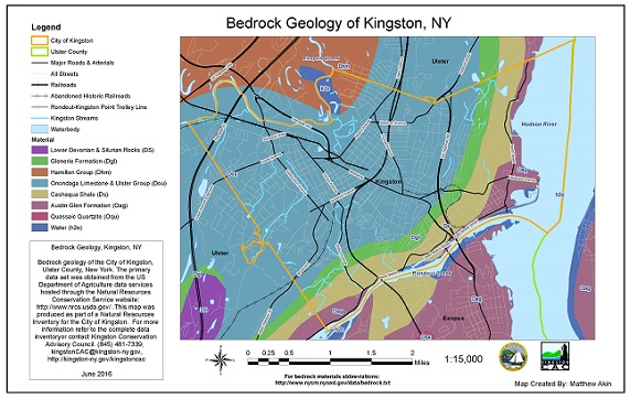
- maps that show the location and extent of existing resources, such as forests, surface and ground waters, and important wildlife habitat
- data and information sources that provide additional detail about features displayed on maps, such as water quality monitoring data or soil properties
- descriptive report that describes the project goals and methods, provides summaries of each resource, and summarizes the findings. Recommendations can also be included.
There is increasing interest in providing access to NRI maps through interactive, web-based mappers; the County and Municipal Web Maps page discusses this option.
Creating a Natural Resources Inventory
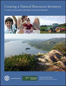
In 2014, our team developed guidance to assist communities and conservation groups with learning how to inventory their natural and cultural resources. Creating a Natural Resources Inventory: A Guide for Communities in the Hudson River Estuary Watershed (Haeckel and Heady 2014) was inspired by previous guidebooks written by University of New Hampshire Cooperative Extension and Dutchess County Environmental Management Council.
The guidebook suggests an approach, recommends components to include, explains why they are important, and provides sources of data and assistance. Case studies from the estuary watershed and strategies for using the NRI in local planning are included. The guide was designed for use by municipal and county officials (e.g., conservation advisory councils and planning boards), conservation organizations, watershed associations, and interested citizens, and may also be useful to professional planners, consultants, and developers.
Links to NRIs in the Estuary Watershed
The following list includes examples of county, town, and city NRIs that have been completed in the estuary watershed. Each listed NRI is linked to a website.
County NRIs | Town NRIs | City NRIs |
| Columbia County | Ancram | Beacon |
| Dutchess County | Beekman | Hudson |
| Greene County | Blooming Grove (includes Villages) | Kingston |
| Orange County | Canaan | Peekskill |
| Ulster County | Coeymans (includes Village) | Poughkeepsie |
| Cornwall (includes Village) | Rensselaer | |
| East Greenbush | ||
| Gardiner | ||
| Hillsdale | ||
| Hyde Park | ||
| Kent | ||
| Milan | ||
| Montgomery (includes Villages) | ||
| Mount Kisco (includes Village) | ||
| New Castle | ||
| New Lebanon | ||
| New Paltz (includes Village) | ||
| New Scotland | ||
| Olive | ||
| Philipstown | ||
| Poestenkill | ||
| Poughkeepsie | ||
| Pound Ridge | ||
| Putnam Valley | ||
| Rhinebeck (includes Village) | ||
| Rochester | ||
| Union Vale | ||
| Woodstock |
Adopting and Implementing an NRI
The NRI is complete; what's next? To support conservation planning efforts by municipalities, we worked with long-time partner Pace Land Use Law Center to develop legal guidance and best practices for adopting and implementing NRIs, open space inventories and plans, and CEAs. Best Practices for Adopting Conservation Inventories and Plans: A Guide for Communities in the Hudson River Estuary Watershed explores three options for municipalities that are ready to take the "next steps"—policy statements in resolutions, comprehensive plans, and local laws—and offers procedural guidance and many examples from Hudson Valley communities.
Helpful Links
Fact Sheet on Creating a Natural Resources Inventory
Creating a Natural Resources Inventory: A Guide for Communities in the Hudson River Estuary Watershed (Haeckel and Heady 2014)
Best Practices for Adopting Conservation Inventories and Plans: A Guide for Communities in the Hudson River Estuary Watershed (Hudson River Estuary Program 2023)
Recorded Webinar on NRIs from 2016 (Part of the NYSDEC Climate Smart Community Webinar Series)
Recording of Webinar on NRIs from 2020 (Part of the Conservation and Land Use Webinar Series)


